


Overlander™
Roam The Unknown
Overlander™ is a rugged, multipurpose sat-nav with a 7 colour touchscreen that features turn-by-turn directions for on-road navigation and topography maps for off-grid guidance. Use your Explore account to wirelessly sync your tracks and waypoints across your Overlander, smartphone and desktop.
Overview
Roam the unknown
Built for every part of the journey, Overlander is a rugged, multipurpose sat-nav featuring turn-by-turn directions for on-road navigation covering Full Europe, Middle East, North and South Africa. Includes Tracks4Africa for detailed map and POI coverage across the African continent. Easily switch to off-road guidance with preloaded maps with topography.
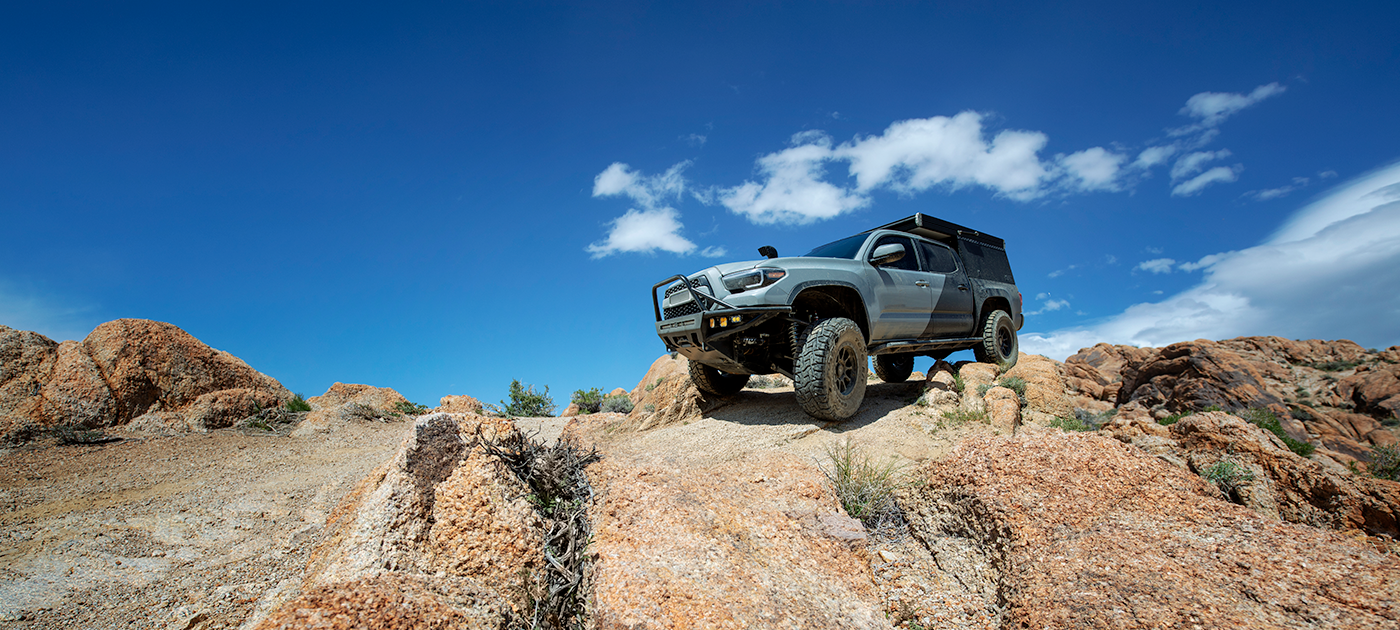
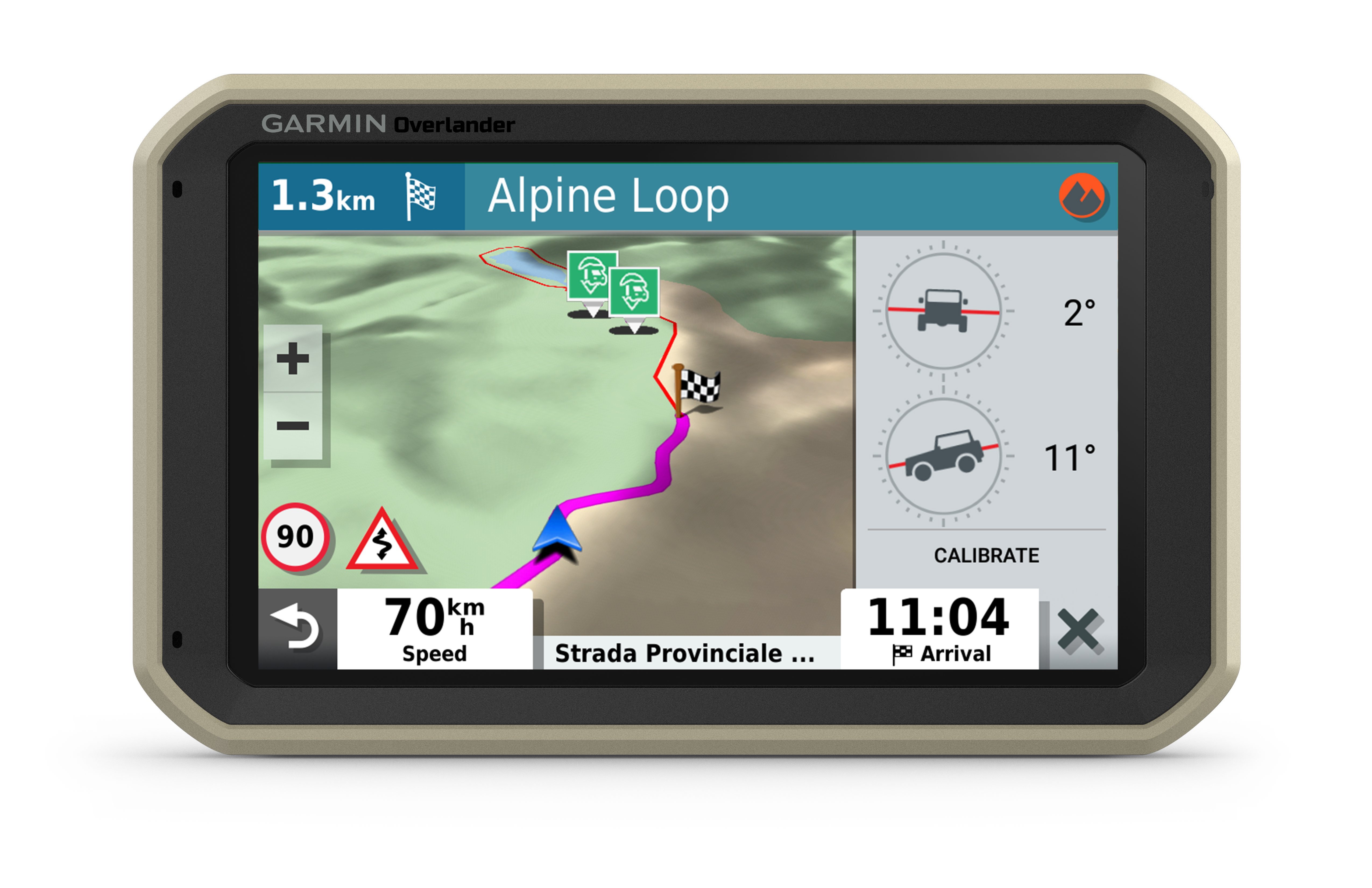
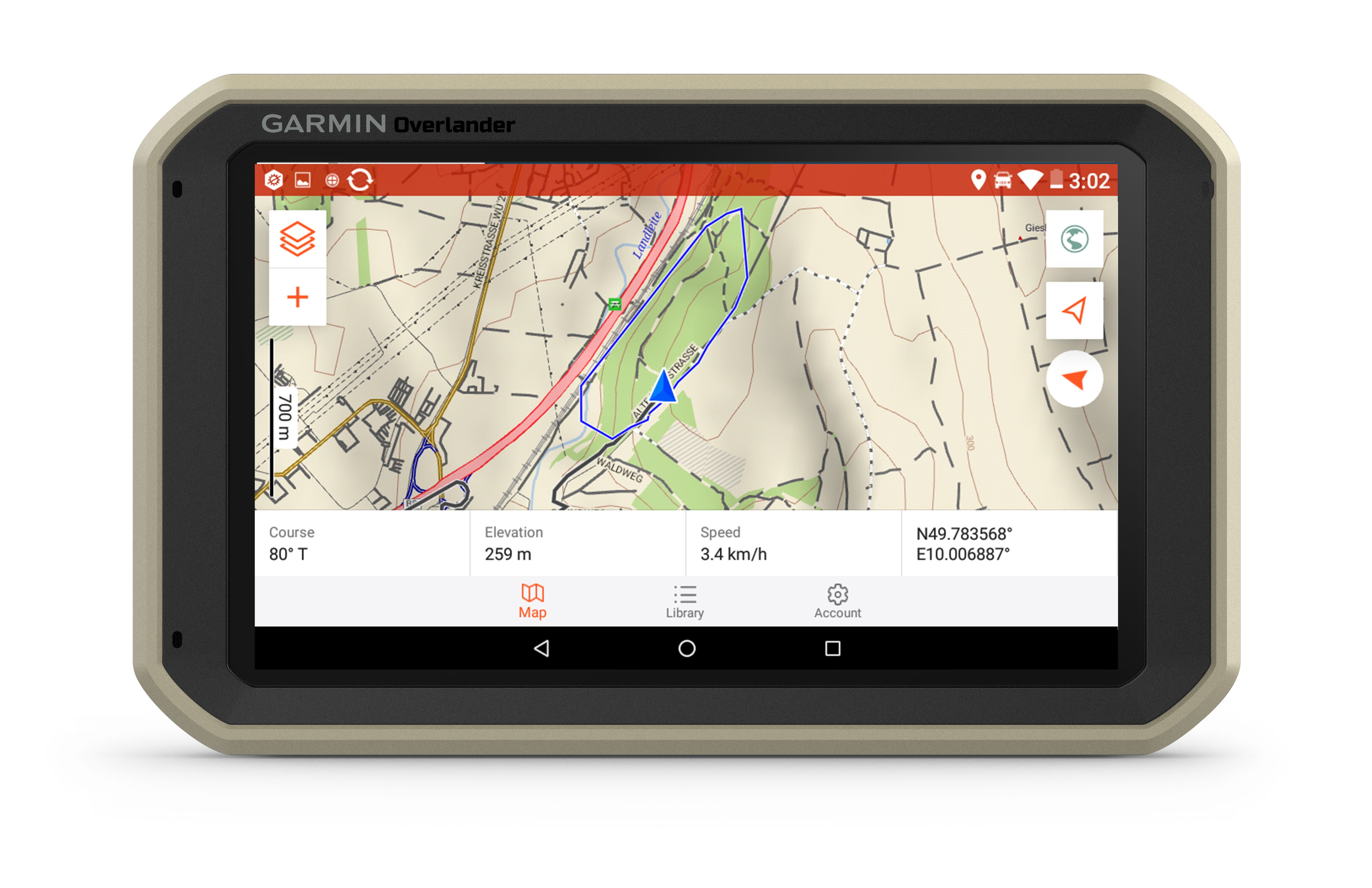
Overlander features integrated pitch and roll angles as well as a compass, altimeter and barometer to help you and your vehicle navigate difficult terrain. A built-in rechargeable battery means you can even take it beyond your vehicle.
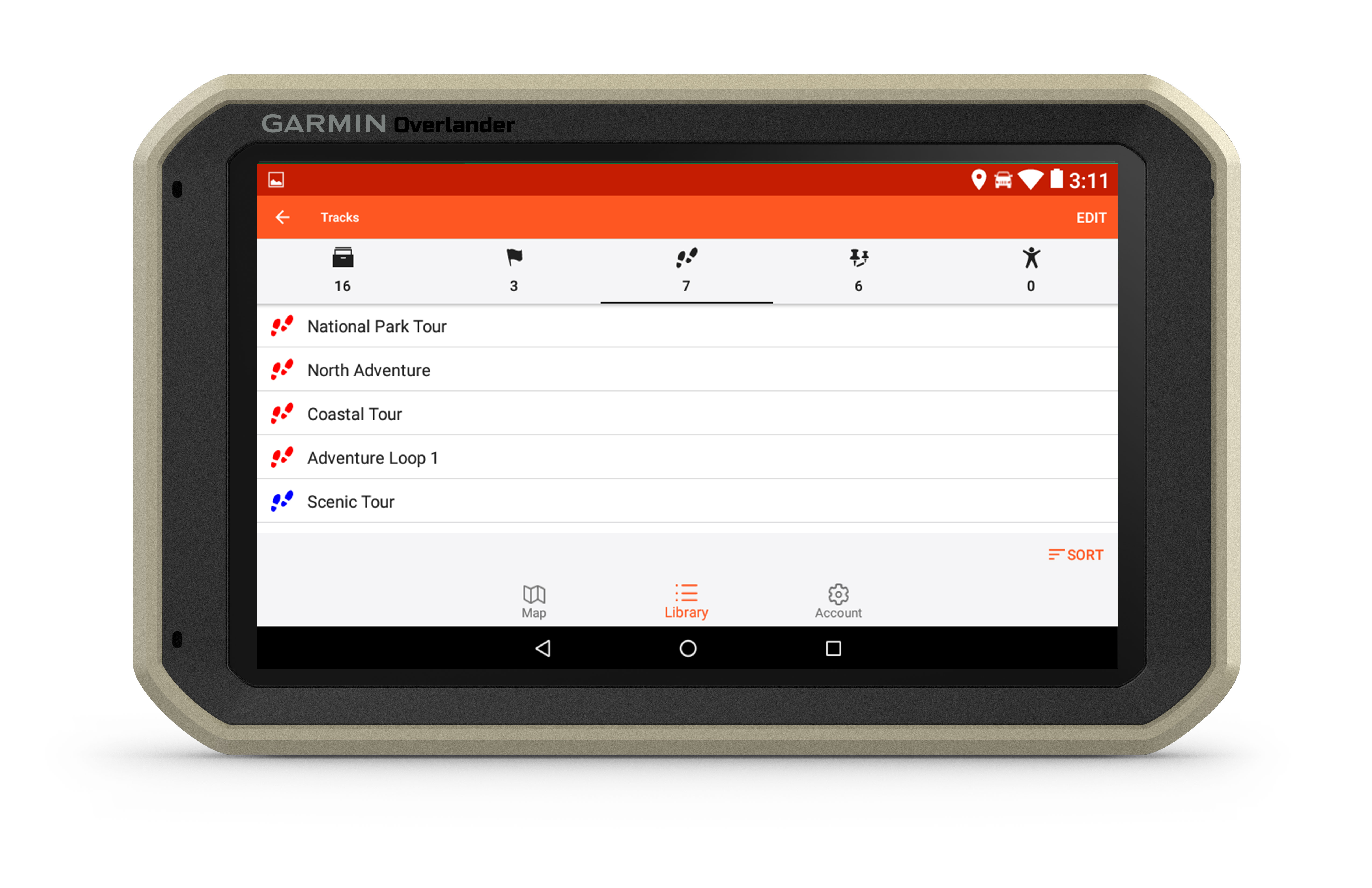
Create a Garmin Explore™ account to plan and map out your next adventure. You can easily record and create routes by tapping the screen on your Overlander sat-nav. Use your account to wirelessly sync — via Wi-Fi®connectivity1 — your tracks, routes and waypoints across all your devices.

On/Off road
7” colour touchscreen features turn-by-turn directions for on-road navigation covering Europe, Middle East and Africa, and topography maps for off-road guidance. Includes 64GB internal memory to download additional TOPO maps.
Garmin Explore
Use the Garmin Explore app to sync all of your waypoints, tracks and routes between devices1.
Find campsites
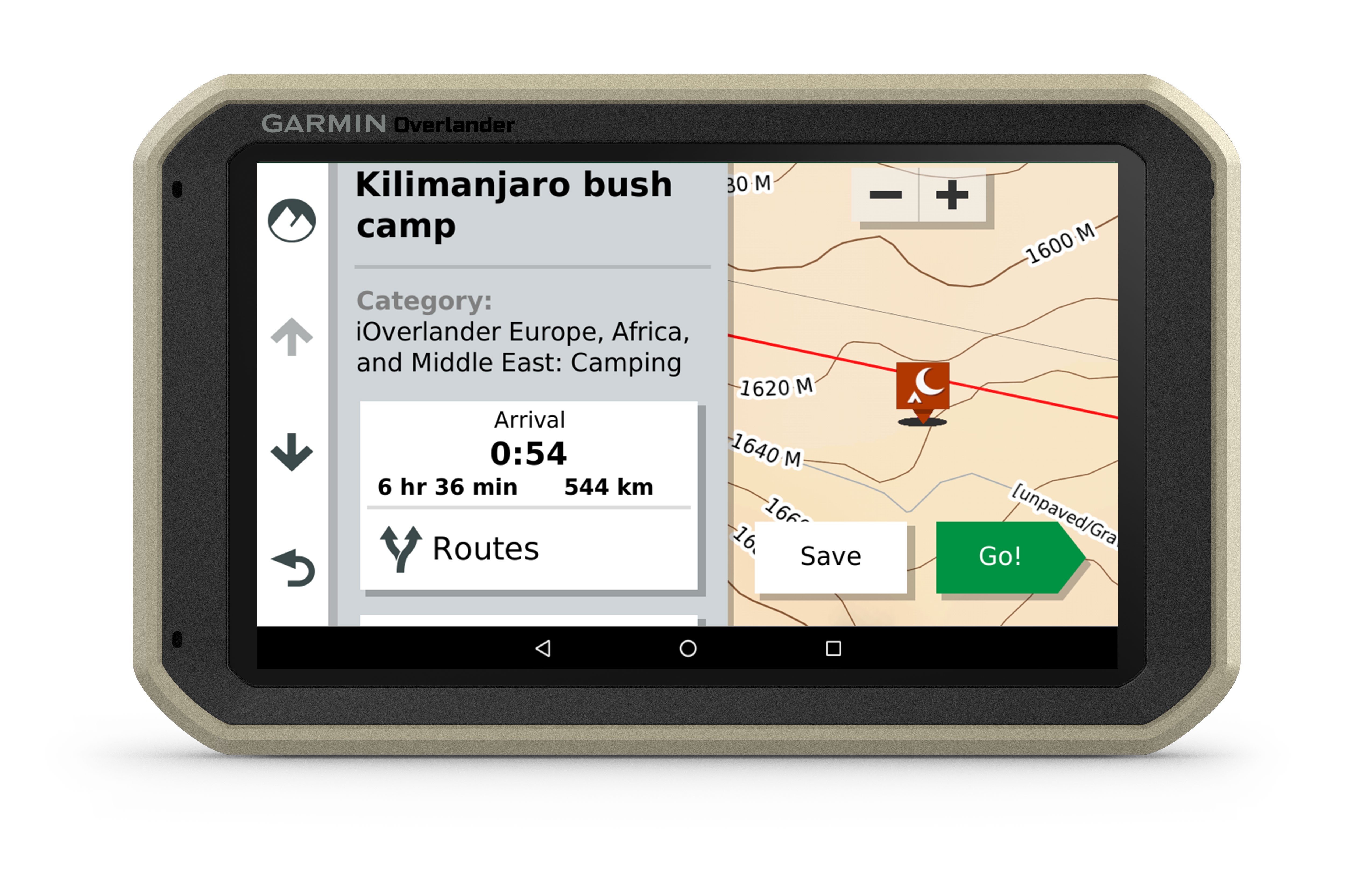
Preloaded with iOverlander™ points of interest (POIs), ACSI™, Campercontact™ and Trailer’s PARK™, so you don’t need a mobile phone signal to find the best-established, wild and dispersed campsites.
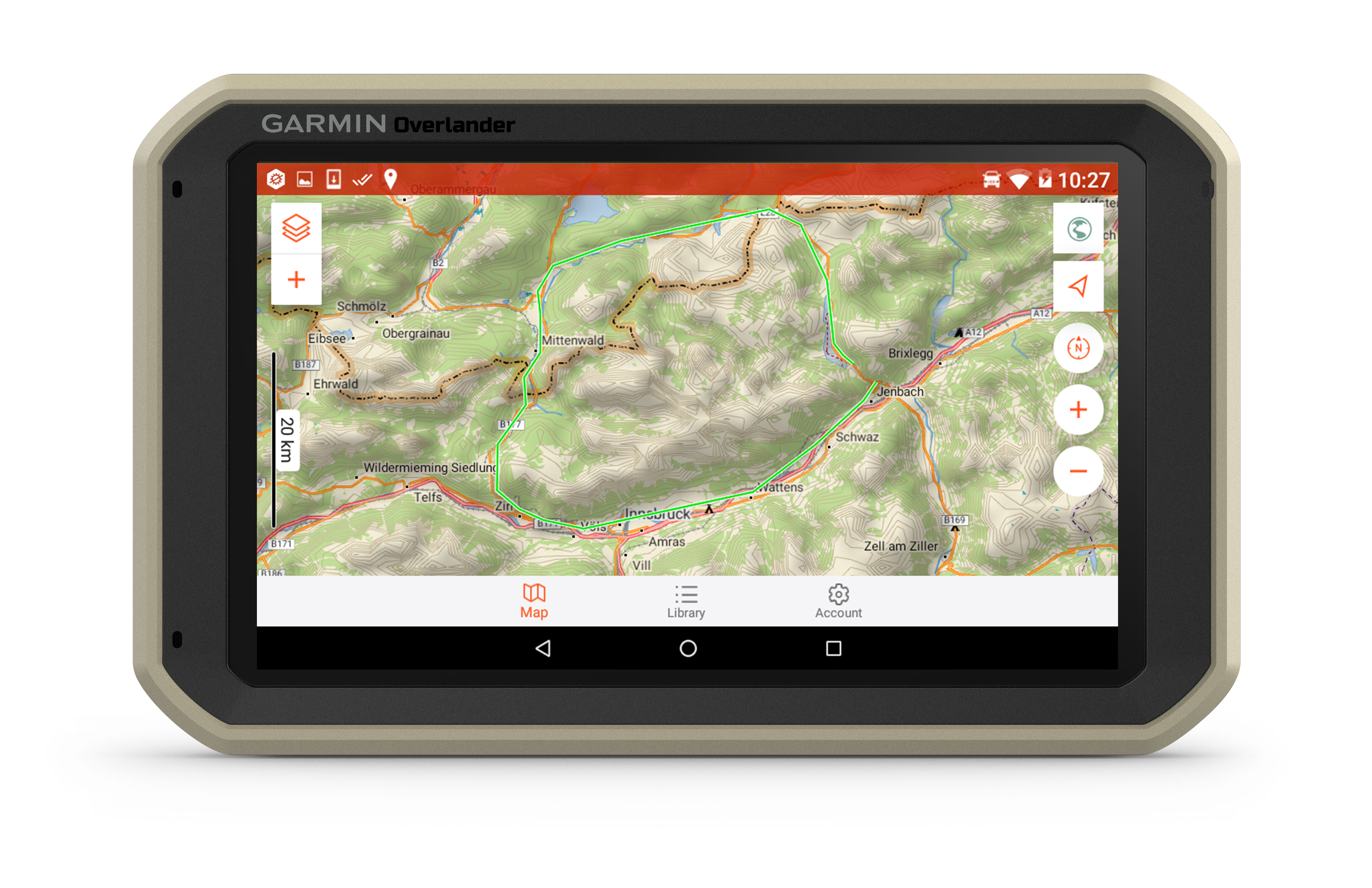
Find boundaries
Features worldwide maps with topography.
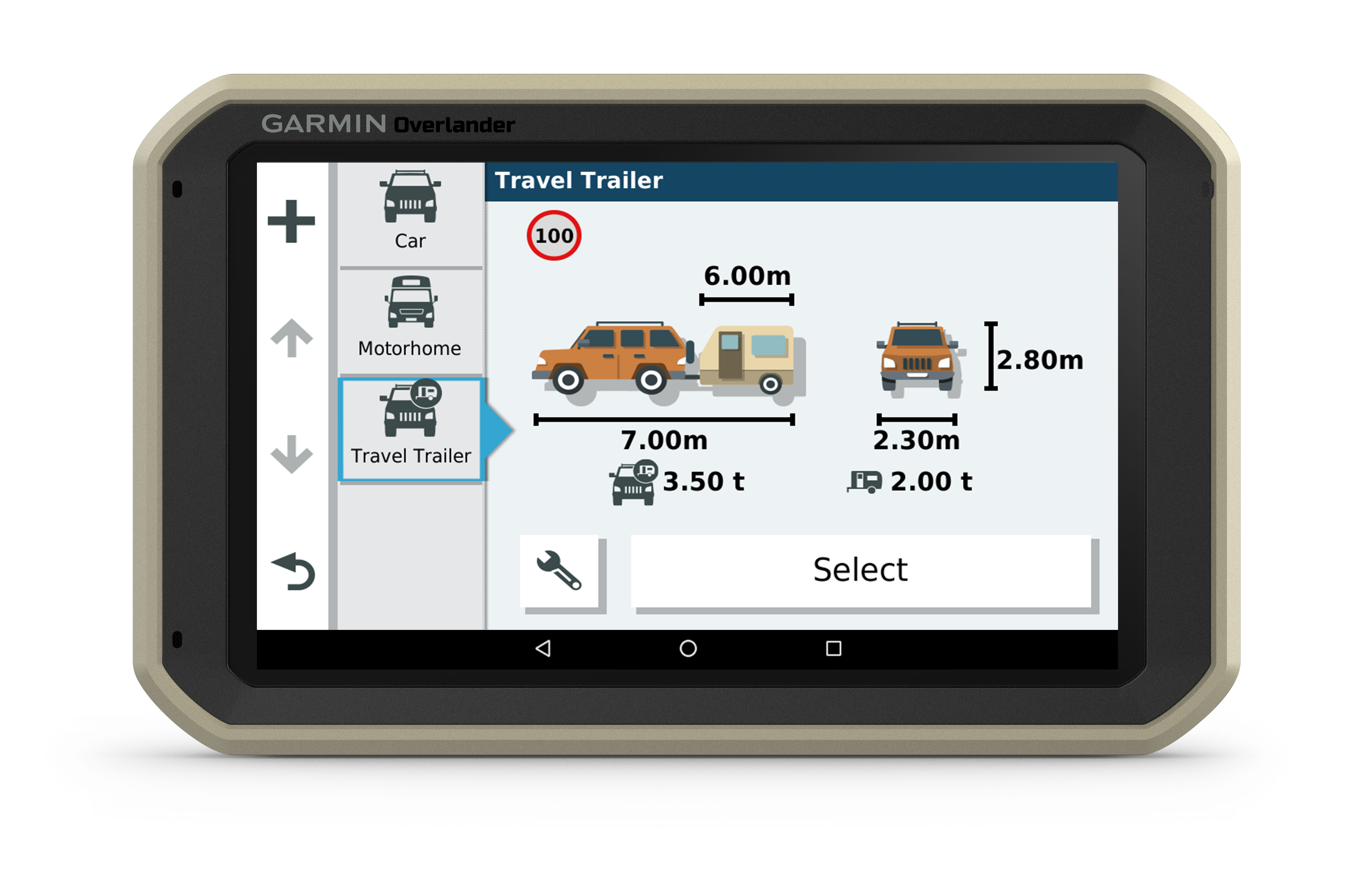
Know your vehicle
Routing is based on height, weight and length for large overlanding vehicles, campers or trailers.

RAM mounted
Can be mounted anywhere with a powered magnetic mount that comes with a suction cup or RAM-compatible adapter.
inReach® compatible
Pairs with inReach satellite communicators2 (sold separately) for two-way text messaging, interactive SOS and weather forecasts.
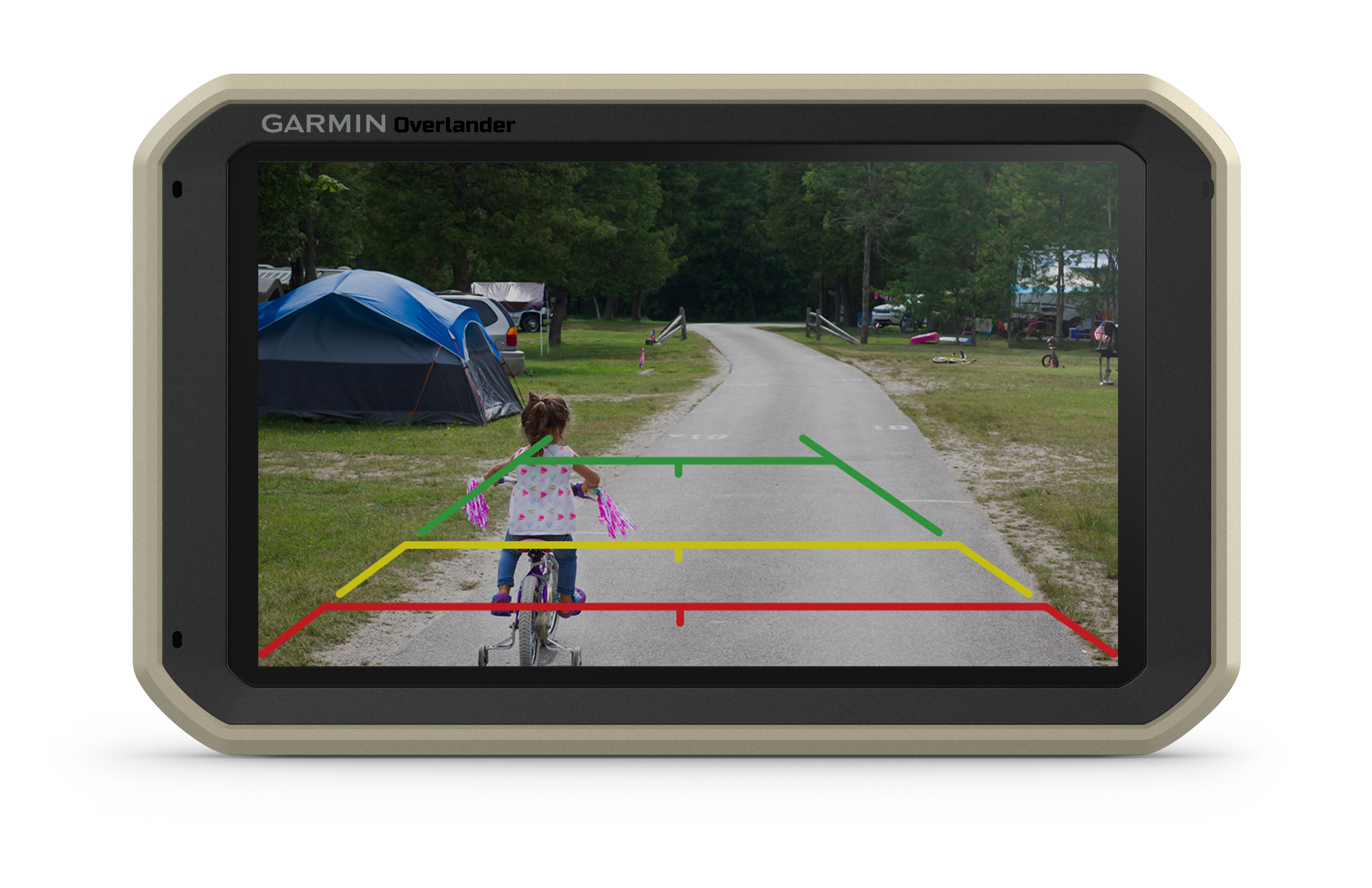
BC™ 35 compatible
Pairs with up to four BC 35 backup cameras (sold separately) so you can see what’s behind you.
Multi-GNSS support
GPS, GLONASS and Galileo support helps track in more challenging environments than GPS alone.
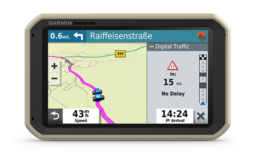
Garmin Digital Traffic
Arrive faster to your off-road adventure with Garmin Digital Traffic, ready to use right out of the box.
General |
|
| Physical dimensions | W x H x D 19.9 x 12.2 x 2.4 cm |
|---|---|
| Display size | W x H 15.2 x 8.9 cm; 7" diagonal |
| Display resolution | 1024 x 600 pixels |
| Display type | Multi-touch, glass, WSVGA colour TFT with white backlight |
| Weight | 437 g |
| Battery type | Rechargeable lithium-ion |
| Battery life | Up to 3 hours |
| Drop rating | MIL-STD-810 |
| Dust rating | IP5X |
| Magnetic mount | |
| 1" ball adapter with AMPS plate | |
Maps & memory |
|
| Preloaded street maps | |
|---|---|
| Data cards | MicroSD™ card (not included) |
| 3D Terrain | |
| Internal storage | 64 GB |
| Includes map updates | |
| Downloadable Satellite Imagery | Yes (U.S. only) |
Sensors |
|
| GPS | |
|---|---|
| GLONASS | |
| Galileo | |
| Barometric altimeter | |
| Compass | |
Outdoor recreation |
|
| Preloaded TopoActive Europe maps | |
|---|---|
Camera features |
|
| Backup camera compatible | Yes (BC™ 35) |
|---|---|
Navigation features |
|
| Garmin Real Directions™ landmark guidance | |
|---|---|
| Millions of Foursquare® points of interest | |
| TripAdvisor® Traveller Ratings | |
| Route shaping through preferred cities/streets | |
| Voice-activated navigation (operate device with spoken commands) Full Europe version only |
|
| Traffic Updates | Yes (with DAB Digital Traffic) |
| Lane assist with junction view (displays junction signs) | |
| Bluetooth® calling | |
| Speed limit indicator (displays speed limit for most major roads in the U.S. and Europe) | |
| Driver alerts for sharp curves, school zones, red light and speed camera warnings and more | |
Advanced features |
|
| Wi-Fi® map and software updates | |
|---|---|
Camper Features |
|
| Specialised Camper Routing | |
|---|---|
| Camper Sites & Services Directory | |
| Road elevations | |
| Speed limit changes | |
| Country Borders | |
Adventure Features |
|
| Pair with compatible inReach® devices | |
|---|---|
| Track recorder (breadcrumbs) | |
| iOverlander™ points of interest | |
| ACSI, Campercontact and Trailer's PARK | |
| Pitch and roll gauges | |
Outdoor applications |
|
| Compatible with Garmin Explore™ app | |
|---|---|
- Overlander
- Vehicle suction cup mount
- RAM ball adapter with AMPS plate
- Traffic receiver/Vehicle power cable
- USB cable
- Documentation
Related Products


